New York is home to many gorges filled with amazing waterfalls. While most of these tend to be in the Finger Lakes and the western half of the state, there are a few great ones in eastern New York. Plotter Kill Preserve protects one of these amazing places.
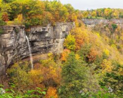
Plotter Kill Preserve is located near Rotterdam in Schenectady County, New York. This 632-acre nature preserve features many miles of great hiking trails, but the main highlight of the park is its three beautiful waterfalls that range from 40-60 feet in height.
While hiking trails lead near the crest of each waterfall, the many miles of hiking trails in the park sadly don’t provide great views of these beautiful drops due to the ruggedness of the terrain. However, I still wanted to visit and see what the area was like and to get the best possible view of the waterfalls here.
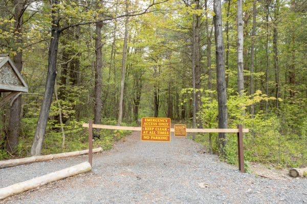
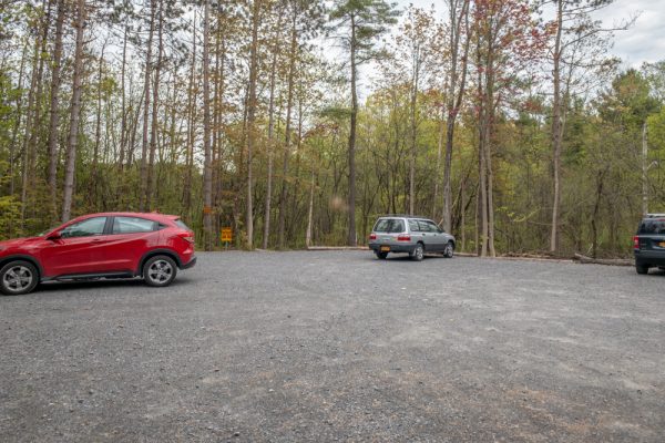
Plotter Kill Preserve features three different parking areas, but the one off of Mariaville Road is the best choice for those looking to visit the waterfalls. (Full directions at the bottom of this article.)
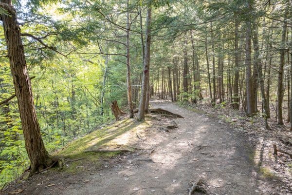
From this parking area, a single trail leads into the preserve.
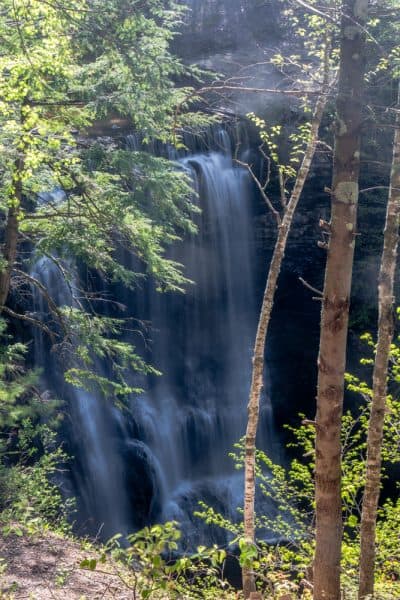
Soon you will reach a split in the trail. If you turn right onto the Blue Trail, you’ll soon come to a nice overlook of Upper Falls, the largest waterfall at Plotter Kill Preserve. This overlook provides the best views of Upper Falls that you can get without getting your feet wet, though it does tend to be a bit overgrown during the summer months. If possible, check this one out earlier or later in the season.
From this overlook, the Blue Trail does make a loop if you continue on it, but there isn’t much else to see. So, instead, return to the trail split and continue straight to follow the Red Trail.
The Red Trail is the park’s longest trail and takes you on a long loop through nearly the entire park if you follow it.
However, within the first 0.6 miles, you’ll be able to pass the top of all three of the preserve’s large waterfalls. The trail has a few hills but is overall not too challenging. However, do look out for the many roots and rocks that are on the trail as they can make it easy to trip.
After about 0.4 miles of hiking from the parking area, you’ll come to the top of Upper Falls. At this spot, as well as near the top of the other two waterfalls, use extreme caution. People have been severely injured or killed here from getting too close to the edge of the falls.
Continuing on the trail for another tenth of a mile, note the marked trail heading downhill to your right. This is the access trail to the base of Upper Falls and is marked with yellow blazes.
The trail is rather steep as it heads down towards Plotter Kill 80 feet or so below the rim. As the trail reaches the stream, it disappears into the water.
To continue on the journey, you’ll need to pick your way across the waterway. Doing this without getting your feet wet is likely impossible. If water levels are high, do not attempt to cross the stream. There is another waterfall just downstream, and one slip could be fatal if the waters are rushing.
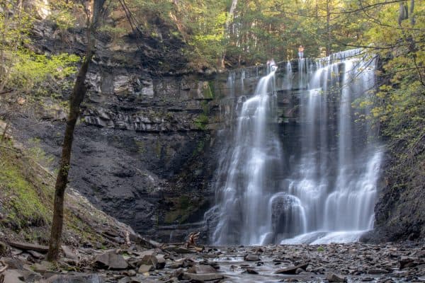
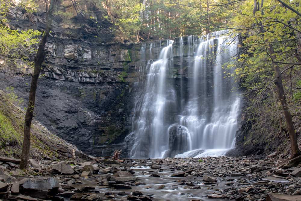
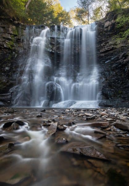
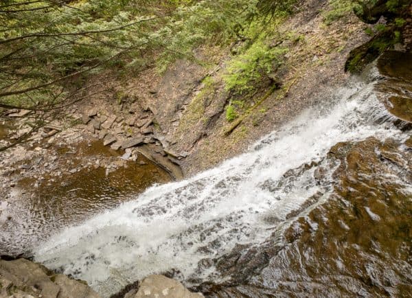
Once across the stream, walk upstream for about 100 yards to the base of Upper Falls. Along the way, you will mostly be able to stay on dry land, but you may have to get in the water depending on the level of the creek.
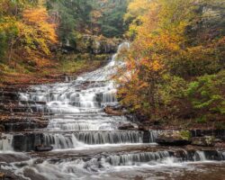
From below, Upper Falls is incredibly impressive. This 60-foot waterfall crashes over the cliff and bounces around on lower rocks before finally falling into a shallow pool at its base.
After taking a few minutes to enjoy this spot, trace your way back to the trail up the hill.
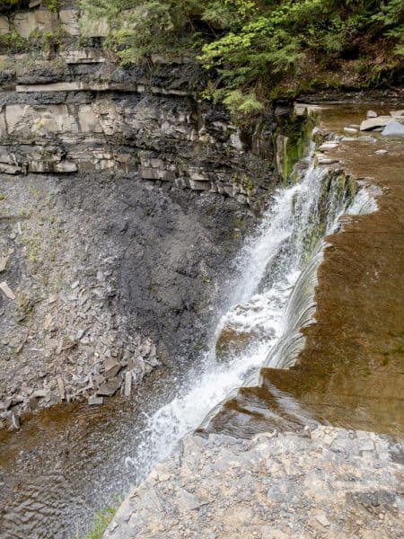
A few steps downstream from the hill, it’s possible to get a look near the edge of the 40-foot Lower Falls. This is the best view from the top of the falls, but again, use extreme caution if you opt to view the waterfall from here.
To continue on the trail, retrace your steps back up the gorge walls to the main trail on the rim.
The Red Trail pulls away from the creek before descending towards Rynex Creek. This creek is a tributary of the main waterway here and features its own 40-foot waterfall that flows almost directly into Plotter Kill.
This is another waterfall that’s impressive to see from above, but where extreme caution needs to be used if you approach the edge.
Looking at the map of Plotter Kill Preserve, it appears that you can reach the base of the falls by continuing further down the Red Trail and then creek walking up to the base of Rynex Creek Falls and Lower Falls.
Unfortunately, I ran out of time at the top of Rynex Creek Falls and had to turn around. Next time, I’ll definitely explore more of Plotter Kill Preserve as I could tell there was a lot more to this park that I hadn’t yet seen.
Overall, the hike along the Red Trail from the parking area to the top of Rynex Creek Falls and back is about 1.5 miles. If you want to see Upper Falls both from the upper viewing area and from below, it’s probably closer to two total miles of hiking.
So, whether you are looking for a nice hike along the rim or are looking for a bit more of an adventure, Plotter Kill Preserve in Schenectady County, New York seems like a great choice.
Hiking at Plotter Kill Preserve
Plotter Kill Preserve is located near the towns of Rotterdam and Schenectady in New York’s Capital Region. It sits about 30 minutes from downtown Albany and only a few miles from both I-90 and I-88. If you are looking for waterfalls near Albany, this is one you won’t want to miss.
There are three parking areas for the preserve, but the best one for those wanting to see the waterfalls is located off of Mariaville Road at the following coordinates: 42.825302, -74.051736.
From here, follow the gated trail that leaves from the parking area and follow the directions listed above to see the waterfalls of Plotter Kill Preserve.
Looking for more places to visit nearby? Check out Amsterdam Castle, the covered bridges of Schoharie County, the Indian Ladder Trail in Thacher State Park, and Ushers Road State Forest.
[Click here for information on how to use the coordinates in this article to find your destination.]


Please!! Take your garbage with you when you visit this beautiful place. The amount of garbage I saw today on the hike was overwhelming. Please be responsible and leave our beautiful preserve the way nature intends it. It is a wonderful beautiful hike other wise.