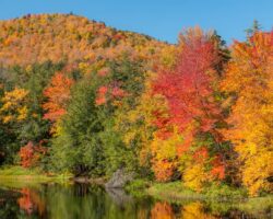
Located in the southern reaches of the Adirondacks, Auger Falls is a great spot to check out if you love waterfalls and are visiting the region.
Auger Falls is located along the Sacandaga River in the Siamese Ponds Wilderness of the Adirondacks. It is a short distance north of Wells, New York, near the intersection of Route 8 and Route 30, and close to East Jimmy Creek Falls and Whiskey Brook Falls.
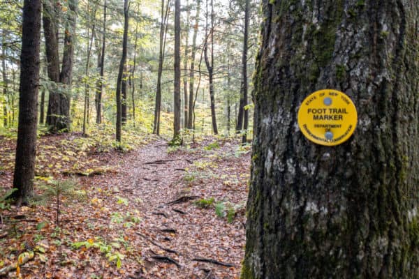
The hike to the top of the waterfall is about 0.4 miles one way and is a great trail for the whole family. This is a very scenic area for hiking, though the trail does start off along a heavily-rutted dirt road before turning into the woods.
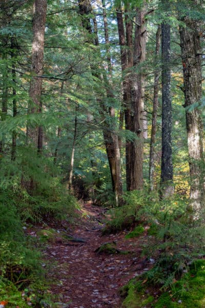
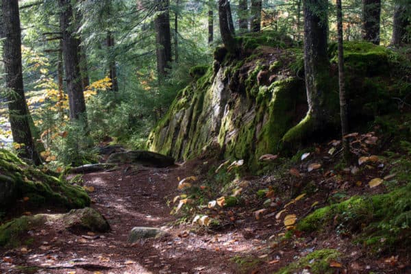
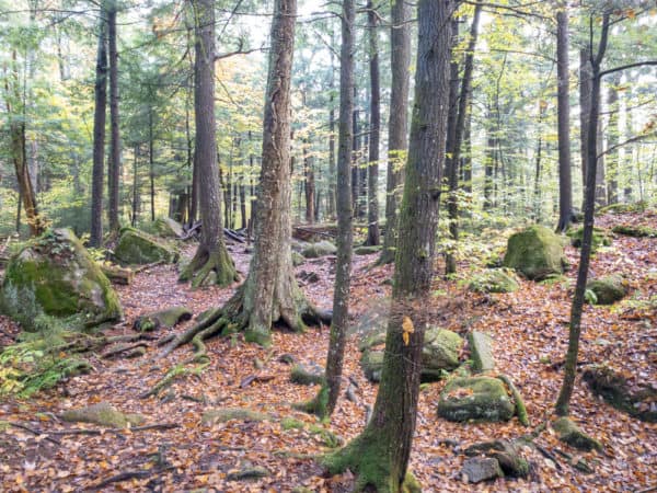
This section of forest is incredibly beautiful and the trail winds its way past towering trees and around large boulders.
The trail eventually reaches a large open area above the Sacandaga River. Below this area is Auger Falls.
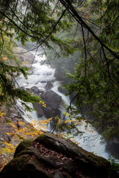
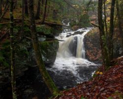
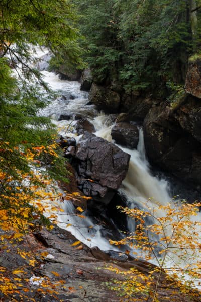
Auger Falls drops roughly 40 feet in a series of three drops. While it may be possible to reach the bottom of the falls, the hillside here is very steep, and I would think that most visitors wouldn’t be able to get to the base of the waterfall.
Fortunately, the views from the top are quite good, though tree branches do make photographing the falls a bit tricky.
From the top of Auger Falls, you have two choices. You can simply retrace your steps back to your car for a roughly 0.8-mile hike or you can continue to follow the river upstream for a loop hike.
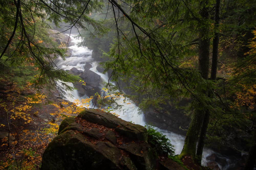
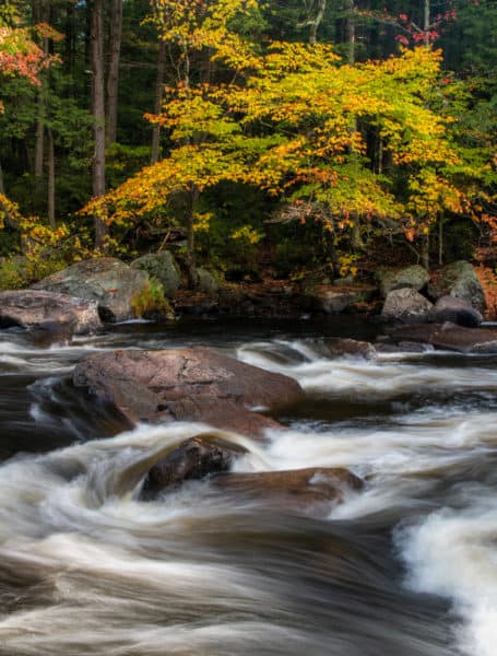
I opted to follow the river upstream and definitely recommend that you do that same as the area above the falls is incredibly scenic.
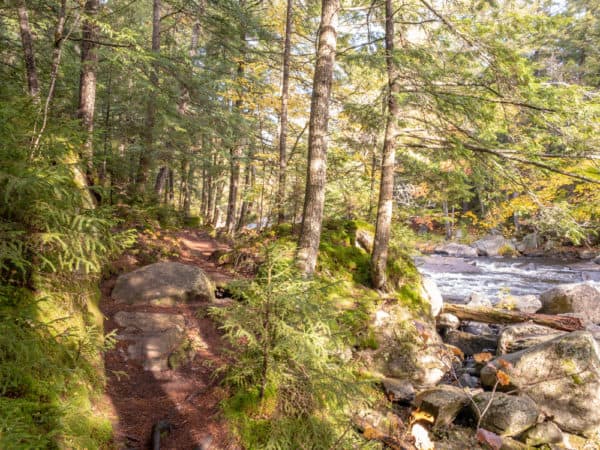
A short distance past the top of the waterfall, the trail reaches the river and follows very closely to it. It’s worth noting that if water levels are especially high, the trail may be difficult to impossible to take beyond the top of the waterfall.
For the next half mile or so, the trail winds its way along the Sacandaga River. While the trail isn’t well marked, it’s very easy to follow. There are also many spots to stop and relax along the trail, but obviously exercise caution along the river’s edge.
After 0.4-0.5 miles from the top of Auger Falls, the trail makes an obvious turn away from the river and into the woods. This turn is unmarked but is hard to miss. And, as long as you stay along the river, you can always retrace your steps back to the waterfall if you are afraid you missed the turn.
Follow the trail into the woods for a short distance until it ends at a gravel culdesac.
This is actually the end of the road along which you parked. Follow this road for a couple of hundred yards back to your car.
While Augers Falls isn’t the largest or most impressive waterfall in the Adirondacks, it’s an incredibly beautiful spot and one of the best waterfalls to visit in the southern part of the region. Even better, the Auger Falls Trail is incredibly scenic (aside from the first and the last few minutes of the hike) and is perfect for the entire family.
How to Get to Auger Falls
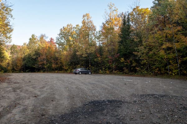
Parking for Auger Falls is located a short distance north of Wells, New York and the Route 8/Route 30 split in Hamilton County.
Parking is along a wide dirt road just off of Route 8 at the following coordinates: 43.469219, -74.252142.
Park somewhere along this road, making sure not to block access to other cars parking here. Given that this road is a few hundred yards long, there is ample parking here.
Once parked, walk back towards Route 8. You’ll see a rutted dirt road heading off to your left (on your right when driving in from the main road).
Walk along this road for a couple of hundred yards until it ends. While there is room for a few cars to park at the end of this road, the condition of the road makes it better to park in the main area, in my opinion, even if you have a high clearance vehicle.
At the end of the road, take the obvious marked trail to your left and follow it to the falls and the trail beyond it.
For those that use coordinates, Auger Falls can be found here: 43.467385, -74.246297.
Looking for more places to visit nearby? Check out Stump City Brewing, Dunkley Falls, Lake George boat tours, and Natural Stone Bridge and Caves.
[Click here for information on how to use the coordinates in this article to find your destination.]