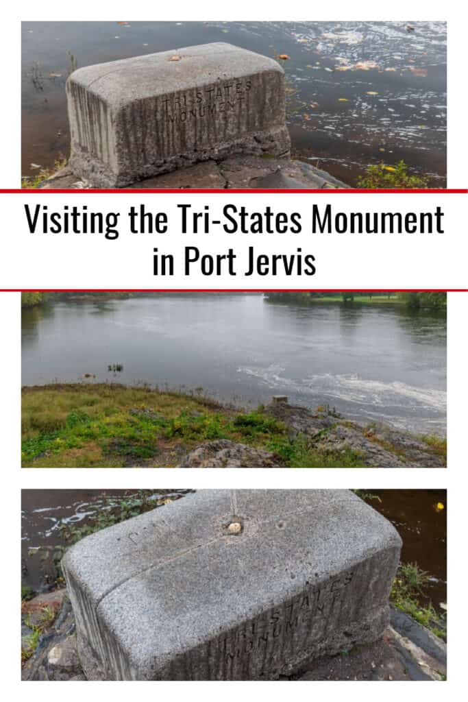
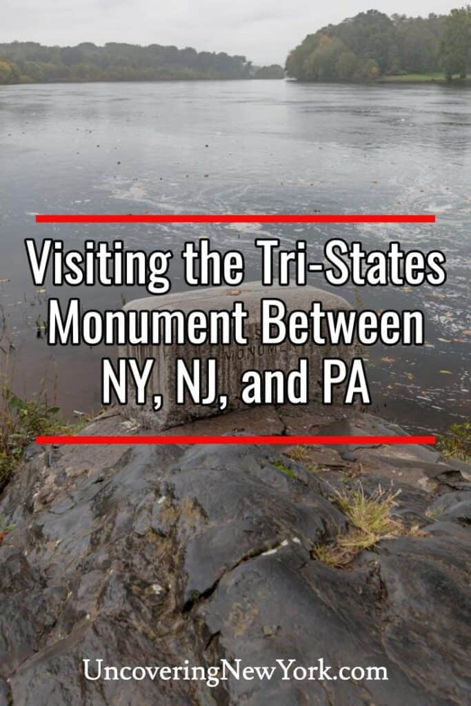
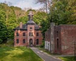
I always love finding quirky sites when I’m traveling, so on a recent visit to Orange County, I made a point of stopping at the Tri-States Monument in Port Jervis.
The Tri-States Monument is located underneath the I-84 bridge on a thin point of land in the middle of the Delaware River known as Carpenter’s Point. This spot symbolically marks the spot where New York, Pennsylvania, and New Jersey meet.
I say symbolically because the actual meeting point is approximately 450 to the west of the marker, but since that would be in the middle of the river, this point of land was chosen to represent the meeting point of the three states.
Interestingly, while this spot can only be reached by land from New York, if the state lines on Google Maps are correct, the monument technically sits just over the border in New Jersey. You’d think they would have at least placed the marker on the NY/NJ line, even if they couldn’t do it at the exact tri-states point.
To reach the Tri-States Monument, you’ll need to drive through Laurel Grove Cemetery. Note that the cemetery is open from sunrise to sunset, so don’t try to visit this spot when it’s dark out.
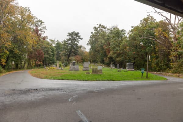
Enter the cemetery through the southern entrance off of East Main Street. The roads through the cemetery are very narrow in places and most only allow one-way traffic, so this is the only entrance you can use if driving back to the monument.
This entrance can be found at the following coordinates: 41.361580, -74.685823. You can also use the address for the florist that sits directly next to the entrance: 4 South St, Port Jervis, NY 12771.
Once in the cemetery, simply follow the main road straight back (don’t take any turns) for half a mile. Once you get to the very end of the cemetery, you’ll see the towering pillars that support the I-84 bridge that passes overhead.
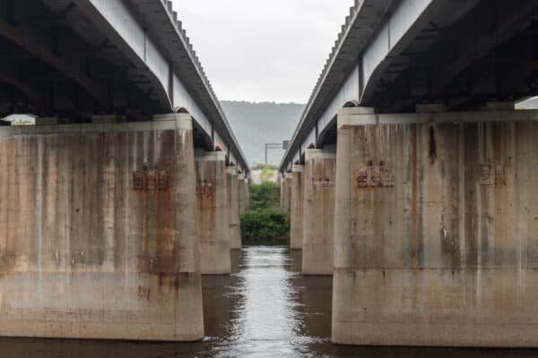
Park in the paved area directly under the bridge. While I thought about providing coordinates to the parking area, since it sits directly below the I-84 bridge, your favorite GPS would likely not direct you below the bridge but to the spot on the bridge. Use the directions I mentioned in the previous paragraph with the coordinates/address for the entrance to the cemetery, to find this spot.
If you look towards the water and the confluence of the Delaware River and the Neversink River, you’ll see a rocky area below you and near the water. If you are facing downstream, the monument will be on the right side of this area.
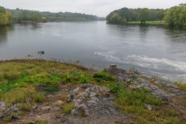
The walk down to the Tri-States Monument is only a few feet and isn’t overly difficult, but it is a bit steep and rocky. Note that, if the Delaware River is especially high, it’s possible that the monument could be underwater or close to it. Make sure to use caution if the river is raging.
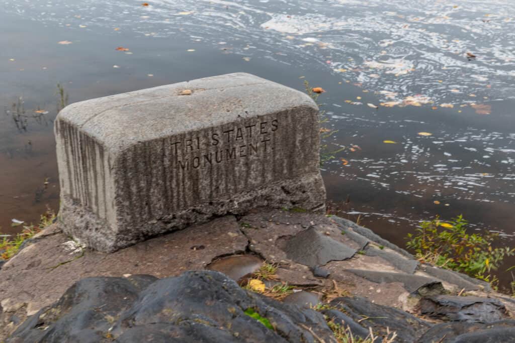
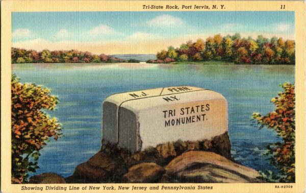
This monument is a bit easy to overlook amidst the rocks of the area as it only sticks out about a foot above the terrain and is made of gray granite.
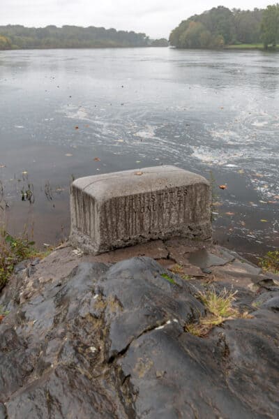
The monument is fairly basic, simply carved with its name, Tri-States Monument, on the side facing the parking area. On top, there are lines to mark the directions of the boundaries, with the state’s initials carved in showing which state owns which land.
For over 100 years, a U.S. National Geodetic Survey survey marker sat in the middle of the monument, but that has been lost at some point in recent years.
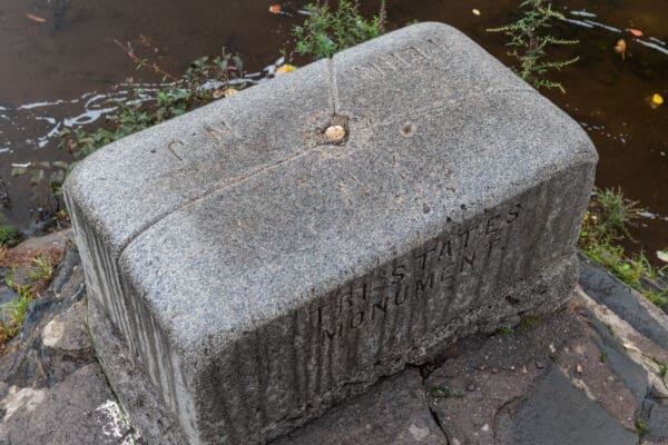
While some stand atop the marker in an attempt to stand in three states at once, remember that the marker doesn’t actually sit on any state line.
As you likely noticed before walking down to the Tri-States Monument, there is another granite monument next to the parking area. This is known as the Witness Monument and is supposed to mark the line between New York and New Jersey.
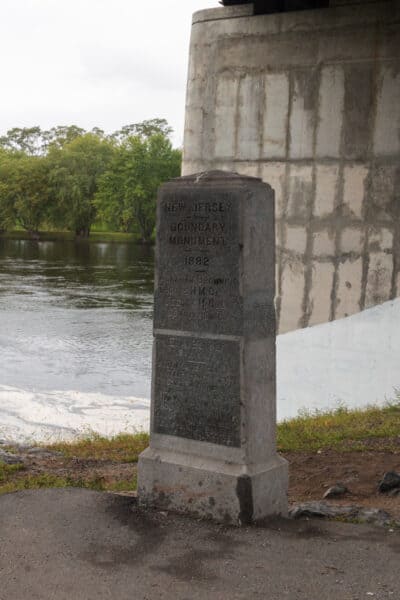
This monument is larger and more impressive looking than the Tri-States Monument, but it also doesn’t sit on any state line (though it is closer).
Overall, the Tri-States Monument is a quirky little spot that’s fun to check out when exploring the area around Port Jervis, New York. While I wouldn’t go far out of my way to visit it, if you are near the city or looking for a quick stop while traveling on I-84, it’s a fun spot to stop for a few minutes.
Looking for more places to visit nearby? Check out Minisink Battleground Park, the Roebling Delaware Aqueduct, and the Mongaup River Trail. There are also a lot of great things to do in the Poconos on the PA side of the river.


My Dad and brother fished setting on that Monument in the 1950s to the late 1960s.we moved to Seattle in 1965 for my dad to help build the first 747. I spent my life there as a firefighter. That photo brings back memories. Captain Stephen Wheeler Retired.
Just a couple of simple facts. First Google Maps are NOT precisely accurate enough to show ANY boundary precisely….they represent a “picture”. In my opinion , as a Professional Land Surveyor, the monument itself more than likely DOES set on the boundary line between New Jersey and New York, while as you point out the actual point of the three States meeting is out in the river where Pennsylvania connects to NY and NJ. The actual disk placed by the USGS years ago is not “lost” – but rather has been stolen by some low life ignoramus and had to be forcibly chipped out of the monument itself. The “Witness Monument” near the parking area and up the bank from the water , references by bearing and distance, where the actual meeting point (or “corner” in surveyor language) where the 3 states meet from the disked monument below. It certainly is a very unique and interesting site and worth anyones time to search it out and enjoy the scenic view.
Interesting article (members of the Highpointers Club–those seeking to summit all 50 state high points and other notable peaks also have some interest in reaching boundary markers). Mr. Williams commentary is right on too. Thanks!
The laws of New York and Pennsylvania and a recent geological publication by the New Jersey government all define the intersection as Tri-point Rock. See https://en.wikipedia.org/wiki/Tri-States_Monument for links.
There are at least 4 other Tri-State points at the edges of Pennsylvania: (1) PA/OH/WV, near Glasgow, PA (technically in the Ohio River, and evidently no marker); (2) PA/MD/WV, near Markleysburg, PA, a point on the Mason-Dixon line with a rough stone marker; (3) PA/MD/DE, near Strickersville, PA, a “new” 1849 stone marker denoting the Mason-Dixon Line; and (4) PA/DE/NJ, near Logan Twp, NJ, where Delaware’s “12 mile circle” meets the eastern bank of the Delaware River (evidently no marker). Cool stuff!